
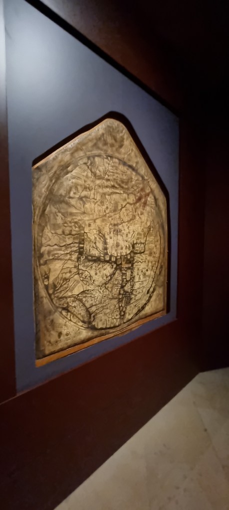
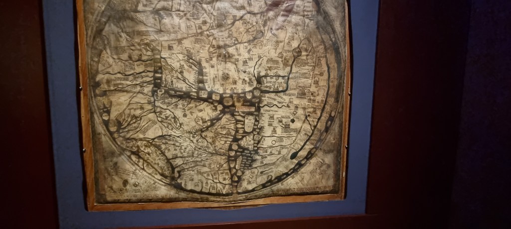
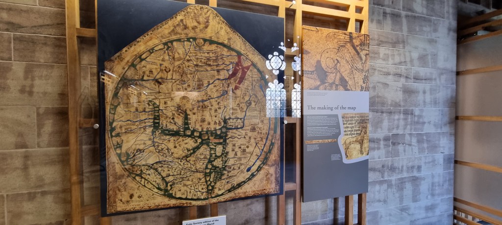
An old medieval map. From the 13th century they say, and is said to be the largest of the old maps. This one resides in Hereford Cathedral. The drawn version is below, so you can see the detail and locations of things. Haven’t things changed a lot since then? They say people just got maps wrong back then, but perhaps things were different, and the land and water distribution was not as we know it today.

(c) K Wicks
