A compilation of article readings about Maps and Islands
Atlantis, No That Would Be Silly
(c) K Wicks

A compilation of article readings about Maps and Islands
Atlantis, No That Would Be Silly
(c) K Wicks
“You want to go to the island.”
The catchy conditioning line used in the film The Island (2005). Making people think there is somewhere better to go and there is a purpose to your being and existence. Replace the island with heaven and I started to see a similarity. Of repeated conditioning of existence, to think after is better than here. And while you are focusing on better there, you perhaps forget or lose sight of trying to make where you are now better.
But back to islands for a moment, because it was actually another that started this thought. It’s from another film, but a certain real island (as far as we know) will tie in, because it’s the film Castaway that came to mind. Of Wilson and the bloody handprint which gets linked to a conspiracy. But that particular premise surrounding that ball often gets mentioned as well as the actor. It’s the location now that takes my thought, a tropical island. Like the one currently linked to a certain news story that rumbles on. The delivery company and packages could also merely be coincidence too. Seeing patterns where we want to and all that.
But the next thought was cows, I know, seems a leap. But as in the first film mentioned, they were being cloned as replacement body parts, treated well until the point of necessity. Just as people will treat prize cows or bulls, or any animal that is bred for what might be considered a ‘superior purpose’, even if that purpose is ultimately food, or body parts. That film My Sisters Keeper I believe is about a ‘spare child’ being born to provide body parts for the first sick child. Scale that idea up I guess. And we end up coming back to a previously discussed idea in Perhaps, of those Warehouses for the Living Dead where people would be neomorts, existing as ‘living cadavers’ waiting to be needed.
Pleasure Island – Pinocchio. I have already mentioned this one too in my article Being Real, of how it was used to entice children into servitude with promises and temptation of fun and vices. But There Is A Price to pay. As it would seem there was for anyone who may have been invited to certain islands, where it seemed it was all fun and games with no repercussions or penalty. But afterwards it is used as a weapon to buy your servitude, turning well-known people into donkey’s, just as they did in the film to the eager and weak-minded youngsters, except they still looked like people and no-one noticed at first. But with strings now attached, having to perform their part, being pulled and played as required, with the direst consequences it turns out…
(c) K Wicks
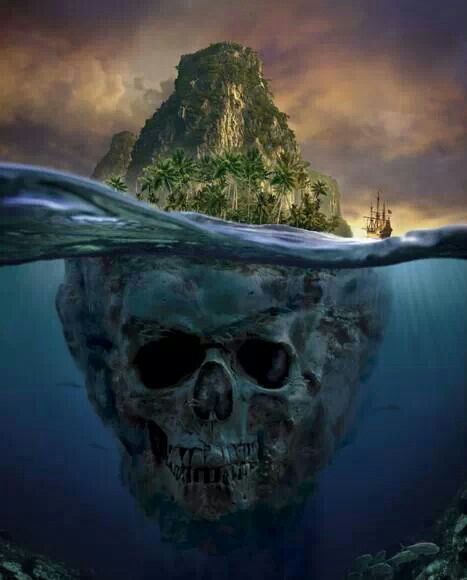
Further to previous articles about maps and islands, An Island, Or Was It? and Atlantis? No That Would Be Silly, I spent some more time looking through maps of the 1500’s. One in particular is currently a favourite which you may be familiar with – Urbano Monte 1587. And an earlier one too, the Mappa Mundi. But in between there are others, showing places that apparently were, but no longer are. Named, routed and landmarks noted. But as far as we are told, they didn’t exist and were just bits of fiction added, or they just ‘got it wrong’, which may well be the case, we know that just because it is drawn or written, doesn’t mean it is real.
I noticed what looked to be an interesting feature on the 1587 map though, a spiral named as Vorago. Naturally I looked up the word, with its meaning being put as – An engulfing chasm : Abyss. And it seemed awfully close to where we have magnetic north showing, a strange feature which looks as though the images aren’t stitched together properly, so it appears fragmented and pixellated, like what happens when you curve something that isn’t supposed to be curved, but what do I know.
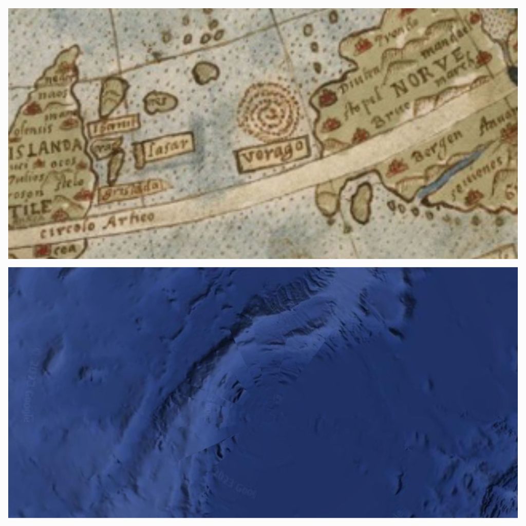
And it can be seen as a diamond formation of dots on earlier maps, this one noted as 1380 in roman numerals, seems very different from the other maps of that time, being that the mappa mundi is apparently from 1300.
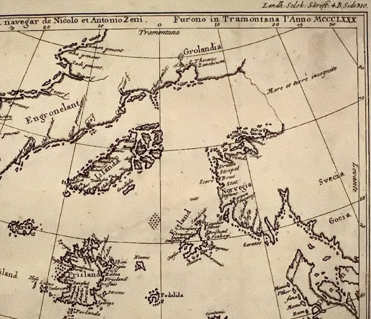
And although it is speculated that most of these places noted above, are in fact modern day Iceland, Greenland, Shetlands Islands and The Orkneys – they say the others just simply don’t exist. Although, when you look at google earth today, there are shapes within the area which could have once been islands perhaps. Which leads back to a reoccurring question for me, if the water level has risen and fallen over time, to reveal land once lost, or cover land we once knew, how could that possibly happen? Could the land tilt, rise or drop? Or is it the water levels that have changed, draining every now and then and creating land bridges and bigger continents for a time, only to be covered again by a deluge from above. As the old saying goes, the waters above, and the waters below…
(c) K Wicks
